The end of the mountains area and the beginning of the desert. This is a unique trip in the area of the transition from the Judean Mountains and Hebron to the northern Negev. In two words "wild route".
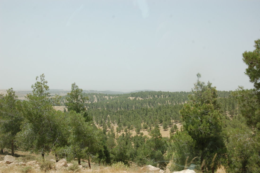
Yatir Forest is a surprising success of a planting project that took place in the 1960s. Against all odds and especially despite the low amount of precipitation in the area, the trees survived and the forest developed into one of the largest planted forests in Israel.
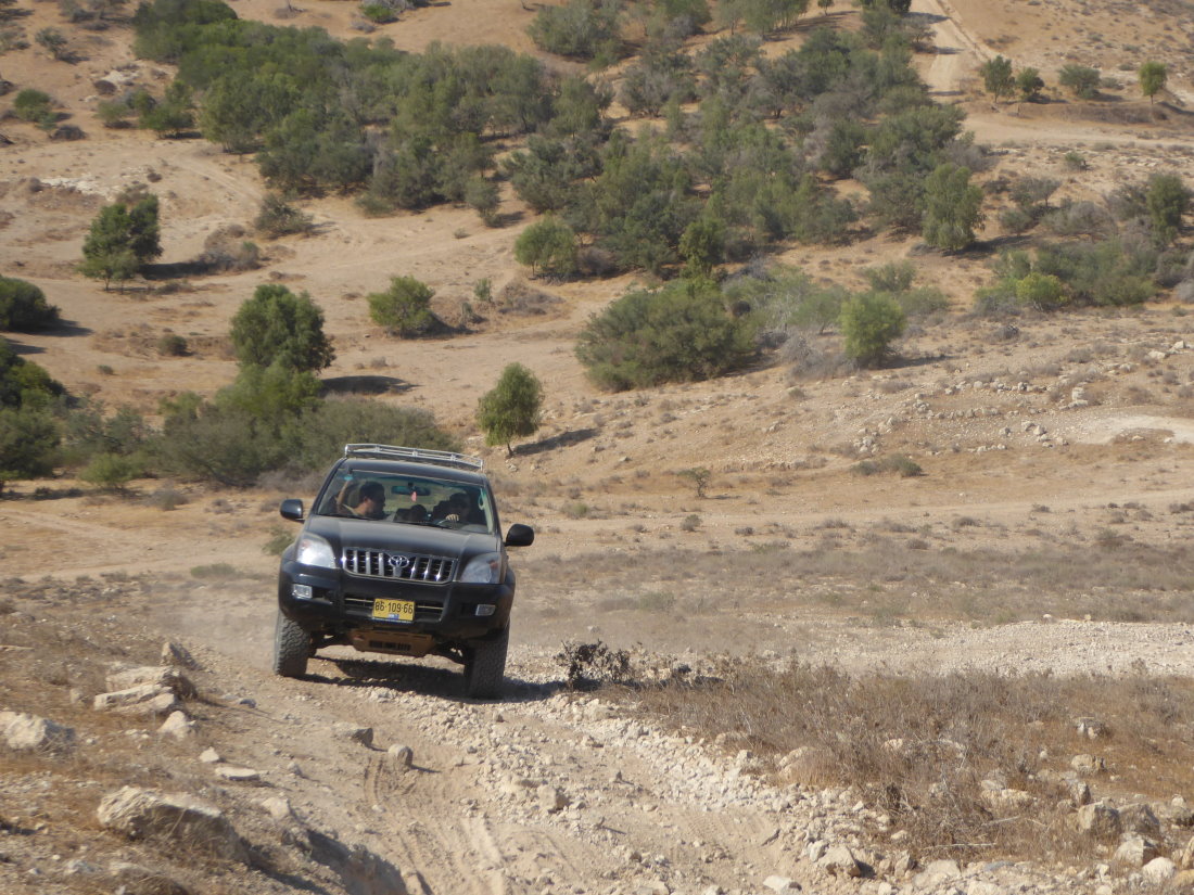
The trip combines some reasonably good dirt roads with trails that are more difficult to drive, some with terrace like obstacles and boulders. On the way you cross several creeks and go through some steep ascents and descents.
Mount Hiran - reached by Ma'ale Hiran. At the summit you should stop for a break. Walk about 50 meters for an amazing view to the southeast and west from an observation point called Mitzpe hasela ("the Rock Observation Point"). From here, we continue driving northeast on the ridge line, where on the left you can see the separation wall, the settlement of Tene and Dahariya and later pass near Khirbet Atir.
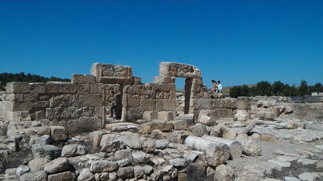
Aniyim Ruins - In the area you can stop in the woods for a meal break and a walk to the ruins. Khirbet Aniyim is called in Arabic Khirbet Al'uyina a-Tahta. The highlight of the place are the remains of the synagogue from the days of the Talmud. An elongated structure that opened to the east. In the foreground are columns on square sills with capitals. Parts of a marble basin for hand-washing and a mosaic floor were also found here. According to remains found at the site - including gold coins, archaeologists concluded that the synagogue was active until the 8th century AD. On a short walk around the area you can see additional buildings, caves used for living and burial caves, cisterns, remains of an ancient oil factory and more.
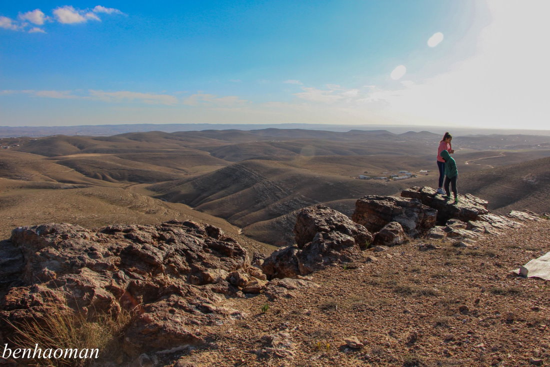
Mount Amasa - We ascend to the summit on a path strewn with small boulders. We will reach an altitude of 850 meters to find a spectacular vantage point from which we can view all directions and especially the southern Judean Desert. We descend the mountain on the same path we ascended it and continue in the direction of Ma'ale Aviasaf.
Mount Aviasaf - Ma'ale Aviasaf is a steep ascent where we will encounter stone fall and terrace-like obstacles. Driving on this trail requires attention and low range power gear. Towards the top the trail splits and the trail that leads left is more challenging. The trail also goes down a bit and then we pass through a rocky trail to continue up to the top of Mount Aviasaf where we can view the beautiful scenery from the observation point.
Livne Cliff (white cliff) - Further down the road you can go on a small detour to Livne Cliff which is an amazing cliff overlooking Nahal Aniyim to the south and east. The name in Hebrew follows the English name from the map of the British Mandate period "white clif" - which is a bit odd due to the fact that the cliff is dark and not white.
Tel Yeshua - On the way to the end of the route we pass by Tel Yeshua. At the top of the hill you can make a detour into the ruins that have thick walls. Going ahead we cross several creeks and pass by Bedouin settlements to reach the end of the route at the "Molda" interchange on Road 31.