Area: Ramon crater and the Negev mountain.
Length: About 55 km.
Duration: One day.
Degree of Dificulty for soft off-road cars: Medium to difficult.
Degree of Dificulty for tough off-road cars: Easy Recommended seasons: Sprint, automn, winterSafety and Security: some areas need coordination with army training timings
Summery: We glide into the wonder of Ramon crater on a proper road and come out of it in the end though a steep dirt trek, proceeding north through the oil pipe route, Hava creek and the mysterious tunnels of the thirsty snake. In the middle we have a beautiful climb to the top of mount Gvanim (the name means "color hues").
The starting point is in Mitzpe Ramon - a small town that borrowed its name from the amazing huge crater near which it is situated.
We start at the southeast exit of the town, just below the pedestrian bridge that stretches from the visitors center. About 150 m later, on the right, an observation deck, which in recent years has become a feeding area for friendly mountain goats, sometimes too friendly.
From there we drive to the bottom of the crater on a road called "Ma'ale Ha'atzmaut," which was built in 1953 by the Engineering Corps as part of "Operation King's Road" to open a driving route to Eilat.
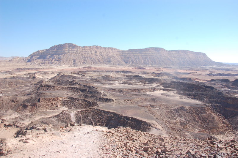
Ramon Crater is the largest crater in the world: its length is 40 km, its maximum width is 9 km and its walls are 200-350 m high.
It takes a drive of about 3.0 km to reach the bottom of the crater by road.
Then we pass the right turn to what is known as "the sawmill" or "the carpenter's workshop" - an area strewn with fragmented rocks that resemble wood logs and bricks.
We drive on ahead until we part from the road turning southwest at a specific point. After a while we reach mount Gvanim and start climbing it. At a certain point the climb gets to be a bit tougher to drive and those cars that have low range grear are advised to use them.
The climb culminates at a beautiful vantage point 595 m above sea level. You will find a flat slab of stone engraved with a map of the surroundings. Looking straight ahead you will see a cylindrical top shaped mountains. After years of army training in the area it got the name "Har Hayehida", which means "the (special) unit mountain". This name came about after many training courses of one of the best special opps army units that kept forming their team names in stone after a race climb to its top. Climbing this mountain entails confronting a 5 meters vertical wall. There is no marked path to the place and officially it is forbidden to climb it.
From Gvanim mount we can drive down on one of three paths. West, where we came from, north, or south. We prefer the southern way down, which is pretty easy to drive. While climbing down the mountain we reach Gai Zohalim ("valley of reptiles"), on the left we will see a wall of colorful sand stones. On the right red grounds. This will be a perfect time to let the kids go out and run around collecting and filling bottles of sand in various colors.
Going ahead we will reach and turn left on road number 40, for a short drive of about 6 km where we go off road again to the left and along Gvanim creek. Gvanim ("hues") is not the only name given to things around here but it is significant and rather natural as the whole area is strewn with sands and rocks of various colors and hues.
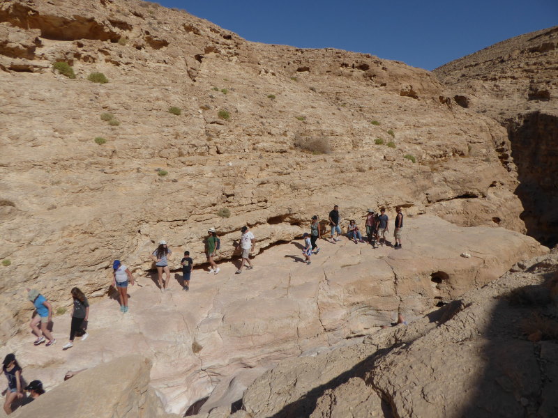
On the way we pass through Ein Saharonim and quite a remarkable slope but rather easy to drive through. Ein Saharonim is a spring ("ein" is the shortened version word for "Ma'ayan" which means "spring"). In the winter the water flows out but during the summer they hide beneath the ground and you can see areas thicker vegetation vouching for the existence of underground water.
It is recommended to walk around. You will see a sign with explanations of the area and you could easily imagine the ancient trails of caravans that passed through this very same trail 1500 - 2000 year ago. Nabati tribesmen leading hundreds of camels loaded with spices and perfumes brought in a tough and dangerous journey from the area of the the Arabian Peninsula, heading to the port of Gaza, from where their precious cargo would continue on its way to Greece and Rome.
After the hike in the area we continue north west on a dirt road suitable for any type of car. We navigate our way to the oil pipe route (again) and find the sign to Ma'ale Noah. Ma'ale means "going-up" and that means of course that we are about to select our way out of the huge Ramon crater.
On the north, as we crose the valey of Mahmal, we can see path of Ma'ale Mahmal climbing up on the wall of the crater. It is a part of the Oil pipe route. It is sort of mythological path, rather dangerous and we happily desmis it as an unnecessary adventure.
We proceed to Ma'ale Noah. "Noah" means comfortable, and as we start the climb on the path we experience how true it is to its name. Here we go into low range gear - if we have it, and if not we maintain and uninterrupted continues drive - so as not to get stuck not being able to re-start driving up the slope.
When we reach the top we are rewarded with a beautiful vantage point and a beautiful view of mount Ardon. At this point a tea/coffee bread is simply a must.
Going ahead in the direction of Mitzpe Ramon we will encounter a few terrace-like obstacles which we will have to overcome with lots of patience + directing each other carefully.
The path that goes along the Eilat-Ashkelon Oil Pipe cuts right through the topography of the land and the result is a bit of a roller coaster of ups and downs.
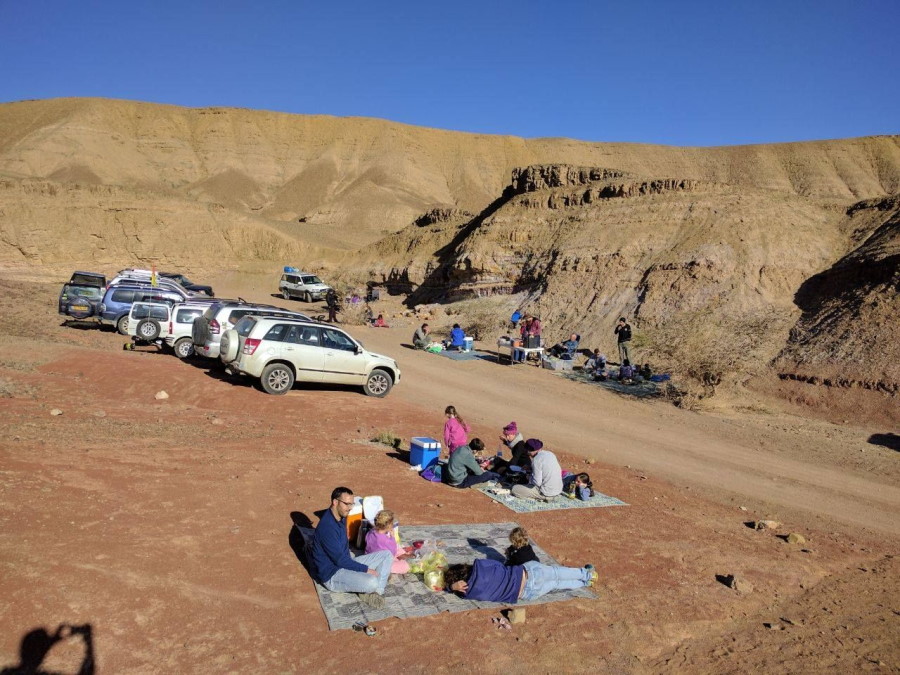
On the way we stop in Hava creek and take a short and beautiful hike to the Hava water ponds. A mere 500 meters walk will bring us to the waterfall of Hava creek. The biggest pond will be found further down the falls - about 40 minutes walk. It is advisable to leave someone to watch the cars.
There are two ways to exit Hava creek. One of them is rather steep, through the beautiful Ma'ale Hava and the other is a long and winding, and rather bumpy by pass on the left.
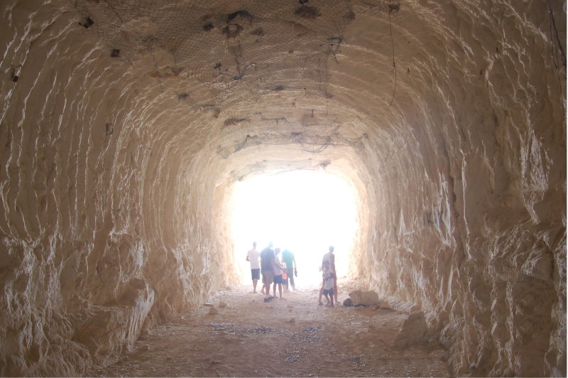
At a certain point we have the choice to either continue straight ahead or take a detour to see the amazing tunnels of "Nahash tzame" ("Thirsty snake"). These tunnels are an unused part of the Oil Pipe Line project (originally a joint project of Israel and none other than... Iran!!!).
The path to the area of the tunnels goes winding down the slope and if the car has a low undercarriage you will need - at certain parts - someone standing outside giving you directions.
About 10 km will bring you to a wide even plain - commonly known as "Ha'mirpeset" ("the balcony"). From there you can see the beautiful view of Tzin valley in the front while at the back you can see the entrance to the two artificial tunnels dug in the stone. The one on the right is blocked while the left one is open for entry by foot.
The tunnels were supposed to be used as oil reservoirs, but all experts efforts to insulate them proved futile and they could not be used to store any kind of fluid. With time the right side tunnel was blocked by stone-fall while the left remained half open. All sort of roomers are tied to the tunnels - from secrete banquets of the army leaders, to storing stolen uranium.
What about the source of the name "Nahash tzame" ("Thirsty snake") which was given to the nearby creek? From the Arabic name it seems to mean "so dry that even the snakes feel thirsty in it".
Going back to where we started the tunnels detour we continue driving south west and then west on a relatively good and fast dirt track. We navigate our way along Nafha creek and after a while reach the end of this trip on road 40 opposite Nafha Gail house